A topographical survey maps and measures the physical features of a land surface, including elevation, contours, boundaries and both natural and man-made features. Traditionally this requires ground-based surveying teams with total stations and GPS equipment — a process that can be time-consuming, expensive, and difficult on large or hard-to-access sites.
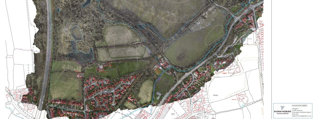
At Hummingbird, we use survey-grade drones equipped with LiDAR sensors and high-resolution mapping cameras to carry out topographic surveys faster, safer and more cost-effectively. Our captured data is processed using photogrammetry and LiDAR processing software to produce accurate 3D models, digital terrain models (DTMs), digital surface models (DSMs) and contour maps — all referenced to Ordnance Survey National Grid (OSGB36) and supported by ground control points (GCPs) for maximum accuracy.
What You Receive
Every drone topographic survey we deliver includes a tailored set of outputs to suit your project requirements. Typical deliverables include contour maps, spot height data, CAD drawings (DWG/DXF format), digital terrain models, digital elevation models (DEMs), and orthomosaic maps. We work closely with architects, engineers and planning consultants to ensure our survey data integrates directly into their workflows.
Industries We Serve
Our drone topographic surveys support a wide range of sectors across South Yorkshire and the wider UK, including construction and civil engineering, residential and commercial development, land and estate management, environmental assessments, planning applications, and infrastructure projects. Whether you need a one-off site survey for a planning application or regular surveys to monitor earthworks on a construction programme, we have the equipment and expertise to deliver.
Why Choose Hummingbird?
Based at Doncaster Sheffield Airport, we combine experienced CAA-authorised drone pilots with enterprise-grade equipment and professional processing software. Our clients — including Harworth Group, Gleeson Homes and Liverpool John Lennon Airport — trust us to deliver accurate, reliable survey data on time and within budget. Get a free quote for your project today.