Recently, we took on the challenge of surveying Liverpool’s John Lennon Airport. This required meticulous planning and coordination to ensure the safety of all aircraft and personnel.
Our approach to surveying a live operational airport
Surveying an operational international airport presents challenges that go well beyond a standard site survey. The airspace is active, the site perimeter is large, and any drone operation must be fully coordinated with Air Traffic Control and integrated around live aircraft movements with no margin for error.
Our approach began with a detailed airspace assessment and formal coordination with LJLA's ATC team, establishing agreed operating windows and communication protocols for every flight. We divided the airport footprint into logical survey sections including runway, apron, terminal zone, perimeter and surrounding land each with its own dedicated flight plan accounting for wind direction, obstacle clearance, solar angle and traffic patterns at the time of capture.
Flights were conducted across multiple days, with each session timed around scheduled operations and confirmed with ATC before departure. Throughout each flight, we maintained continuous radio contact with the tower, ready to hold position or abort immediately if required. All imagery was captured at a consistent altitude and overlap ratio to ensure seamless processing across the full site.
Results
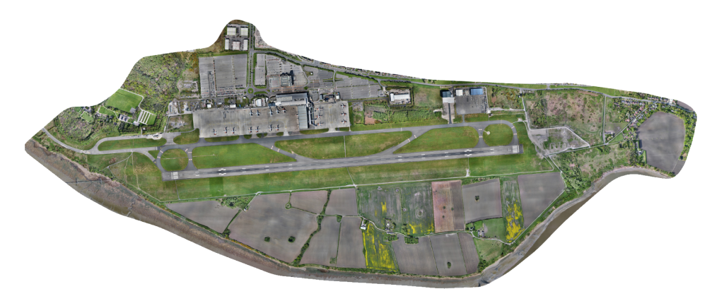
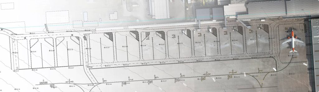
The processed data was used among other things to generate an accurate, very high resolution georeferenced image.
A georeferenced image provides a powerful tool for a variety of applications. By accurately aligning the image with real-world coordinates, it enables precise measurements, spatial analysis, and informed decision-making. This technology opens up possibilities for planning, environmental monitoring, and construction.