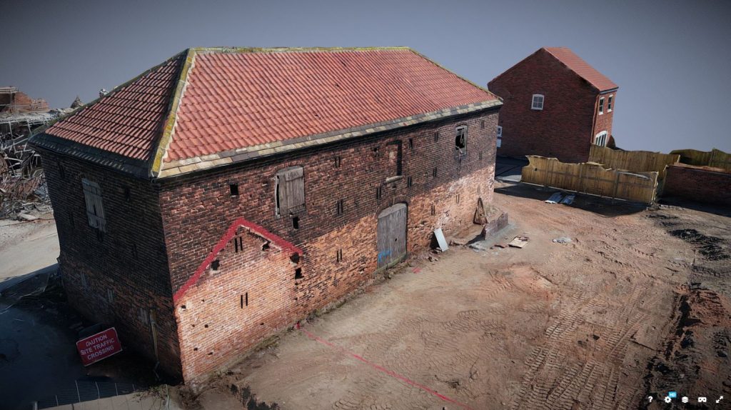
3D photogrammetry modelling uses overlapping aerial imagery captured by drone to generate highly accurate, textured three-dimensional models of structures, landscapes and assets. By processing hundreds or thousands of photographs through specialist photogrammetry software, Hummingbird Technical Services produces dense point clouds, mesh models and orthomosaics that provide a precise digital record of any subject from a single building to a large industrial site.
Operating from our base at Doncaster Sheffield Airport, South Yorkshire, our CAA-authorised team deploys survey-grade drones with high-resolution mapping cameras to capture the imagery required. All processing is carried out in-house using industry-standard photogrammetry pipelines, and deliverables are formatted for direct use in the software packages our clients already work with whether that's Autodesk, Bentley, ArcGIS, Sketchfab or a bespoke viewing platform.
What You Receive
Every 3D photogrammetry project is delivered as a complete data package tailored to your requirements, including:
- Textured 3D mesh model, accurate, photo-realistic and ready for inspection or presentation
- Dense point cloud (LAS/LAZ) for measurement, analysis and integration with other survey data
- Orthomosaic, a georeferenced, scaled 2D map generated from the same imagery
- Digital Surface Model (DSM) for elevation analysis and volumetric calculations
- Web-hosted 3D viewer (where required) shareable with clients and stakeholders via browser
- Output in your preferred format including OBJ, FBX, PLY, E57, LAS or project-specific formats
Industries We Serve
Drone 3D photogrammetry is used across heritage recording, structural inspection, construction and civil engineering, mining and quarrying, insurance and loss assessment, marketing and visualisation, and environmental monitoring. We have produced photogrammetric models for industrial structures, listed buildings, construction sites and landscape features across Yorkshire and the wider UK, with outputs used directly in planning applications, condition reports and client presentations.
Why Choose Hummingbird
Hummingbird Technical Services has been delivering professional aerial survey services since 2019. Our operators hold full CAA authorisation and our equipment includes the latest survey-grade drone platforms with high-resolution mapping cameras. Based in South Yorkshire, we serve clients across Yorkshire, the Midlands, the North West and the wider UK — delivering 3D photogrammetry data that is accurate, fully processed and presented in formats you can use immediately.