An orthomosaic is a photogrammetrically corrected aerial map produced by stitching hundreds or thousands of overlapping drone images into a single, seamless, georeferenced dataset. Unlike raw aerial photography, an orthomosaic is geometrically accurate — corrected for camera angle, terrain relief and lens distortion — meaning every pixel has a precise real-world coordinate. Distances, areas and boundaries can be measured directly from the image with survey-grade confidence.
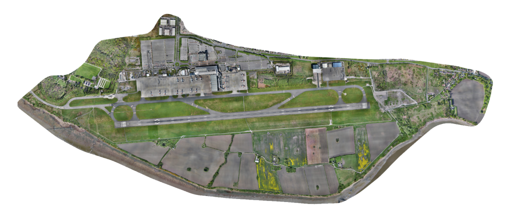
Hummingbird Technical Services produces professional drone orthomosaic maps across Yorkshire and the wider UK, delivering outputs georeferenced to OSGB36 / OS National Grid as standard. Operating from our base at Doncaster Sheffield Airport, South Yorkshire, our CAA-authorised team captures the high-resolution imagery required and processes it in-house, delivering finished maps in the formats your team already works with — GeoTIFF, ECW, MrSID, or project-specific formats for direct use in QGIS, ArcGIS, AutoCAD, Civil 3D and Bentley.
What You Receive
Every orthomosaic mapping project is delivered as a complete data package, including:
- Full-resolution GeoTIFF orthomosaic georeferenced to OSGB36/OSTN15 as standard
- Digital Surface Model (DSM) elevation data generated from the same imagery
- Processing report with flight parameters, GSD (ground sample distance) and accuracy statistics
- Web tile export (XYZ/WMTS) for embedding in online mapping platforms where required
- Delivery in your preferred format and coordinate system
Industries We Serve
Orthomosaic mapping is used across land and property, construction, civil engineering, mining and quarrying, agriculture, environmental monitoring, utilities, heritage and insurance. We have produced hundreds of orthomosaic surveys for clients including Harworth Group and Liverpool John Lennon Airport, and our outputs have been used directly in planning applications, site design, boundary disputes and asset management workflows across Yorkshire and the wider UK.
Why Choose Hummingbird
Hummingbird Technical Services has been delivering professional aerial survey services since 2019. Our operators hold full CAA authorisation and our equipment includes the latest survey-grade drone platforms with high-resolution mapping cameras. Based in South Yorkshire, we serve clients across Yorkshire, the Midlands, the North West and the wider UK — providing orthomosaic data that is accurate, fully processed and delivered in formats you can use immediately.